Hank & Tammy's Buffalo Night Photos

You are visitor (graphical counter) to Hank & Tammy's Buffalo Night Photos

All photos © Hank & Tammy unless otherwise noted.
To email Hank & Tammy, change DOT to "." and AT to @ and remove the spaces and hyphens in the email address

Photos 1 through 31 of 31 total Photos

Search Hank & Tammy's Photos:      
Sort By:   Alphabetical   -   Reverse Chronological   -   Chronological   -   Reverse Filesize   -   Filesize

1/31


This shot looking east all the way down Delaware Park Lake toward Delaware Avenue and Forest Lawn Cemetery was an afterthought. There was just something about the view that I liked. Taken at 11:13 PM, July 15, 2010.
image/jpeg, 1500x1000 (24bit)
EXIF: Focal Length 28mm, Exposure Time 30 Sec., Aperture f10
Show GPS Location in: Google Maps   Bing Maps   (New Window)
DelawareParkLake_07-16-10_1729.jpg    175063 bytes

2/31


We're on the "Curly Bridge" that crosses the Scajaquada Expressway between north Lincoln Parkway and Delaware Park, facing west. The Independence Hall lookalike building is Buff State's Rockwell Hall and to the left above the road sign are the H.H. Richardson designed Buffalo Psychiatric Center administration towers, also shown here. Taken at exactly 11:45 PM, July 15, 2010.
image/jpeg, 1500x1000 (24bit)
EXIF: Focal Length 28mm, Exposure Time 30 Sec., Aperture f22
Show GPS Location in: Google Maps   Bing Maps   (New Window)
ScajaquadaExpy_07-16-10_1735.jpg    338540 bytes

3/31


I had been planning this shot of the Delaware Park Casino for about a month. I wanted to get a clean time exposure when the surface of the lake was relatively calm to provide a good reflection from the other side of the lake. The Delaware Park Casino started life as an 1874 boathouse design. After being enlarged because of its popularity, it was destroyed in a 1900 fire. As the Pan-American Exposition site was just across the lake, it was rebuilt into a new three story building in time for the Exposition's 1901 opening. In 1960 the Casino was modernized, which erased most traces of Buffalo architect E.B. Green's 1900 design. In 1990 the Casino was again renovated, but this time it was "backdated" to better reflect more of the style of its earlier incarnations. Taken at 11:08 PM, July 15, 2010.
image/jpeg, 1500x1107 (24bit)
EXIF: Focal Length 51mm, Exposure Time 30 Sec., Aperture f10
Show GPS Location in: Google Maps   Bing Maps   (New Window)
DelawareParkCasino_07-15-10_1726.jpg    308754 bytes

4/31


The Administration Building of the Buffalo Psychiatric Center was designed by famous architect H. H. Richardson in 1870. This National Historic Landmark was the beginning of his characteristic Richardson Romanesque style. It is currently the focus of a major preservation effort. Taken at 12:09 AM on June 22, 2010.
image/jpeg, 1250x1144 (24bit)
EXIF: Focal Length 33mm, Exposure Time 10 Sec., Aperture f16
Show GPS Location in: Google Maps   Bing Maps   (New Window)
BuffaloPsychCenterHHRichardson_06-21-10_1272.jpg    215674 bytes

5/31


The Connecticut Street Armory, also known as the 74th Regimental Armory, is a historic National Guard armory building at Connecticut and Niagara Streets on Buffalo's West Side. It was built in 1899. Taken at 11:53 PM on June 21, 2010.
image/jpeg, 1450x1097 (24bit)
EXIF: Focal Length 28mm, Exposure Time 13 Sec., Aperture f9
Show GPS Location in: Google Maps   Bing Maps   (New Window)
ConnecticutStArmoryBuffaloNY_06-21-10_1265.jpg    527967 bytes

6/31


This is the view looking south on Main Street from Lafayette Square toward the Marine Midland tower, now owned by HSBC. Taken at 11:36 PM on June 21, 2010.
image/jpeg, 1400x933 (24bit)
EXIF: Focal Length 28mm, Exposure Time 3.2 Sec., Aperture f16
Show GPS Location in: Google Maps   Bing Maps   (New Window)
MainStAtLafayetteSqSouth_06-21-10_1258.jpg    330795 bytes

7/31


This is the view looking north on Main Street at the Lafayette Square trolley station toward what is known as the "Theater District." Taken at 11:35 PM on June 21, 2010.
image/jpeg, 1500x1000 (24bit)
EXIF: Focal Length 28mm, Exposure Time 3.2 Sec., Aperture f16
Show GPS Location in: Google Maps   Bing Maps   (New Window)
LafayetteSqStationMainStBuffaloNY_06-21-10_1255.jpg    356671 bytes

8/31


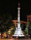
The granite Civil War monument in Lafayette Square, named "Soldiers and Sailors." The woman at the top, over ten feet tall, is an allegorical representaion of the Union. Taken at 11:31 PM on June 21, 2010.
image/jpeg, 1100x1432 (24bit)
EXIF: Focal Length 28mm, Exposure Time 4/5 Sec., Aperture f2.8
Show GPS Location in: Google Maps   Bing Maps   (New Window)
LafayetteSquareBuffaloNY_06-21-10_1252.jpg    335153 bytes

9/31


The top of Central Terminal's tower showing the clocks, setbacks and fleur de lis sculptures at the roofline. Taken at 11:15 PM on June 21, 2010.
image/jpeg, 1200x1191 (24bit)
EXIF: Focal Length 75mm, Exposure Time 1/2 Sec., Aperture f2.8
Show GPS Location in: Google Maps   Bing Maps   (New Window)
CentralTerminalBuffaloNY_04_06-21-10_1251.jpg    145560 bytes

10/31


New York Central Railroad's Buffalo Central Terminal, opened in 1929 and once host to crack streamliners for New York City, Boston, St. Louis and Chicago. Taken from Paderewski Drive at 11:13 PM on June 21, 2010.
image/jpeg, 1300x1213 (24bit)
EXIF: Focal Length 44mm, Exposure Time 3.2 Sec., Aperture f2.8
Show GPS Location in: Google Maps   Bing Maps   (New Window)
CentralTerminalBuffaloNY_03_06-21-10_1247.jpg    260798 bytes

11/31


Buffalo's Central Terminal was abandoned by Amtrak in 1979 and fell victim to looters and vandals in the 1980s and 1990s. In the late 1990s the Central Terminal Restoration Corporation was formed to preserve the building. Great strides have been made since then, but no firm plan for adaptive re-use has yet emerged. Taken from Memorial Drive at 11:08 PM on June 21, 2010.
image/jpeg, 1500x1000 (24bit)
EXIF: Focal Length 57mm, Exposure Time 5 Sec., Aperture f2.8
Show GPS Location in: Google Maps   Bing Maps   (New Window)
CentralTerminalBuffaloNY_02_06-21-10_1244.jpg    215406 bytes

12/31


View of Central Terminal from the "President's Track" at CSX' "Stock Yards" on William Street. Darn those those poles and those power lines! The CSX main line runs past here and the location is known as CP 437 on the railroad. Taken at 11:02 PM on June 21, 2010.
image/jpeg, 1400x926 (24bit)
EXIF: Focal Length 57mm, Exposure Time 10 Sec., Aperture f4.5
Show GPS Location in: Google Maps   Bing Maps   (New Window)
CentralTerminalBuffaloNY_01_06-21-10_1242.jpg    168631 bytes

13/31


View north on the Niagara River toward the International Bridge from the foot of Ferry Street on Squaw Island. The International Railway Bridge carries a single track railroad line owned by Canadian National (CN) and also used by Canadian Pacific (CP) across the Niagara River between Fort Erie, Ontario and the Black Rock neighborhood of Buffalo, New York. It was built in 1873. Until shortly after the formation of Conrail in 1976, there was a fairly busy railroad yard at Black Rock. The twin smokestacks behind the middle of the bridge are for the coal fired Huntley Generating Station.
Taken on June 21, 2010.
image/jpeg, 1600x872 (24bit)
EXIF: Focal Length 75mm, Exposure Time 1.6 Sec., Aperture f2.8
Show GPS Location in: Google Maps   Bing Maps   (New Window)
InternationalBridgeNiagaraRiver_06-21-10_1235.jpg    148043 bytes

14/31


The Peace Bridge, completed in 1927, is over a mile in total length. It is now lit in constantly changing colors at night, which makes for a pretty sight. Taken at 10:15 PM on June 21, 2010 from the foot of Ferry Street on Squaw Island.
image/jpeg, 1600x785 (24bit)
EXIF: Focal Length 28mm, Exposure Time 1/2 Sec., Aperture f2.8
Show GPS Location in: Google Maps   Bing Maps   (New Window)
PeaceBridge_BuffaloNY_03_06-21-10_1225.jpg    178639 bytes

15/31


View of the Fort Erie, Ontario end of the Peace Bridge, which also shows the giant power transmission line tower on the Canadian side and the lights of Fort Erie. Taken at 10:13 PM on June 21, 2010.
image/jpeg, 1600x887 (24bit)
EXIF: Focal Length 28mm, Exposure Time 1/2 Sec., Aperture f2.8
Show GPS Location in: Google Maps   Bing Maps   (New Window)
PeaceBridge_FtErieONT_04_06-21-10_1223.jpg    243296 bytes

16/31


Closer view of the center of the Peace Bridge where the actual boundary between the U.S and Canada is located. The American flag is to the left, the center white flag is the boundary and the Canadian flag is to the right. Taken at 10:12 PM on June 21, 2010.
image/jpeg, 1600x855 (24bit)
EXIF: Focal Length 75mm, Exposure Time 1/2 Sec., Aperture f2.8
Show GPS Location in: Google Maps   Bing Maps   (New Window)
PeaceBridge_BuffaloNY_02_06-21-10_1221.jpg    172092 bytes

17/31


A longer time exposure stretches some trucks on the Peace Bridge and brightens up the whole scene a bit. Taken from the foot of Ferry Street on Squaw Island at 10:06 PM on June 21, 2010.
image/jpeg, 1600x835 (24bit)
EXIF: Focal Length 28mm, Exposure Time 1.6 Sec., Aperture f2.8
Show GPS Location in: Google Maps   Bing Maps   (New Window)
PeaceBridge_BuffaloNY_01_06-21-10_1209.jpg    250759 bytes

18/31


This shot of Buffalo's City Hall was taken from Erie Street near the Erie Basin Marina, approximately 3/5ths of a mile from City Hall. Taken at 12:51 AM on June 21, 2010.
image/jpeg, 1400x933 (24bit)
EXIF: Focal Length 75mm, Exposure Time 30 Sec., Aperture f14
Show GPS Location in: Google Maps   Bing Maps   (New Window)
BuffaloCityHallFromErieBasin_06-21-10_1198.jpg    225635 bytes

19/31


The USS Little Rock at Buffalo's Naval & Military Park. The 610 foot long Little Rock was the first ship to bear the name of Little Rock, Arkansas. She is the only guided missile cruiser on display in the U.S. USS Little Rock is the sole survivor of the Cleveland class, the most numerous of U.S. wartime cruisers (29 vessels total). The Little Rock made four cruises to the Mediterranean and two to the North Atlantic. She served with distinction as flagship for both the Second and Sixth fleets. Launched August 27, 1944 and then commissioned June 17, 1945 at Cramp Shipbuilding Company, Philadelphia, PA. Converted in 1960 at New York Shipbuilding Corporation, Camden, NJ. Decommissioned November 1976. Taken from Erie Street on the Buffalo River at 12:46 AM on June 21, 2010.
image/jpeg, 1400x933 (24bit)
EXIF: Focal Length 55mm, Exposure Time 30 Sec., Aperture f18
Show GPS Location in: Google Maps   Bing Maps   (New Window)
USS_Little_Rock_BuffaloNY_06-21-10_1196.jpg    259318 bytes

20/31


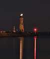
The 1833 Buffalo "Main" Lighthouse and the "Buffalo Bottle" (to the left) taken from Erie Street near the Erie Basin Marina. The Main Light was to be demolished in the 1960s, but was saved by public protest. Taken at 12:44 AM on June 21, 2010.
image/jpeg, 1200x1399 (24bit)
EXIF: Focal Length 75mm, Exposure Time 30 Sec., Aperture f8
Show GPS Location in: Google Maps   Bing Maps   (New Window)
BuffaloHarborLighthouse_06-21-10_1195.jpg    173728 bytes

21/31


The second floor of the old Erie Railroad (later Erie Lackawanna and then Conrail) Louisiana Street Freight House, built around 1908 by the Buffalo firm of Mosier & Summers. Taken at 12:26 AM on June 21, 2010 on the Louisiana Street bridge.
image/jpeg, 1400x933 (24bit)
EXIF: Focal Length 28mm, Exposure Time 8 Sec., Aperture f8
Show GPS Location in: Google Maps   Bing Maps   (New Window)
ErieRR_LouisianaStFreightHouse_06-21-10_1190.jpg    344175 bytes

22/31


Amtrak's Exchange Street Station in Downtown Buffalo, originally built by the new York Central RR in the 1950s. Only trains that run to and from Niagara Falls and Toronto stop here. The red streaks were caused by a truck negotiating the I-190 on-ramp. Taken at 12:18 AM on June 21, 2010.
image/jpeg, 1400x933 (24bit)
EXIF: Focal Length 47mm, Exposure Time 8 Sec., Aperture f8
Show GPS Location in: Google Maps   Bing Maps   (New Window)
ExchangeStAmtrakStation_BuffaloNY_06-21-10_1189.jpg    292936 bytes

23/31


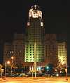
The 294 foot tall Electric Tower in Downtown Buffalo was built in 1912 with additions made in 1923 and 1928. It is lit with various appropriate colors during holidays. It was inspired by the Electric Tower of the 1901 Pan-American Exposition. Taken at 12:04 AM June 21, 2010, less than one minute before the lights went off!
image/jpeg, 1400x933 (24bit)
EXIF: Focal Length 28mm, Exposure Time 8 Sec., Aperture f18
Show GPS Location in: Google Maps   Bing Maps   (New Window)
ElectricBuilding_BuffaloNY_06-20-10_1188.jpg    210425 bytes

24/31


The Liberty Bank Building "twins" perched 300 feet above Buffalo's downtown sidewalks. Contrary to popular wisdom, these 30 foot tall ladies are not scale replicas of the Statue of Liberty. We wanted to shoot them from one more angle, but to our chagrin, we found out that they turn the lights off at midnight. We'll try again another time. Taken from a parking lot at Ellicott and William Streets at 11:56 PM on June 20, 2010.
image/jpeg, 1400x933 (24bit)
EXIF: Focal Length 28mm, Exposure Time 5 Sec., Aperture f18
Show GPS Location in: Google Maps   Bing Maps   (New Window)
LibertyBankBuilding_03_06-20-10_1185.jpg    133501 bytes

25/31


The 30 foot tall "twins" atop the 1925 Libery Bank Building at 424 Main Street in Buffalo. The original name of the company was German-American Bank, changed after World War I to avoid anti-German sentiments. Taken from a parking lot at Ellicott and William Streets at 11:55 PM on June 20, 2010.
image/jpeg, 1400x1234 (24bit)
EXIF: Focal Length 75mm, Exposure Time 5 Sec., Aperture f18
Show GPS Location in: Google Maps   Bing Maps   (New Window)
LibertyBankBuilding_02_06-20-10_1184.jpg    217541 bytes

26/31


One of the Liberty Bank Building "twins" in downtown Buffalo. Taken from Court Street near Franklin at 11:47 PM on June 20, 2010.
image/jpeg, 1200x1067 (24bit)
EXIF: Focal Length 75mm, Exposure Time 5 Sec., Aperture f18
Show GPS Location in: Google Maps   Bing Maps   (New Window)
LibertyBankBuilding_01_06-20-10_1183.jpg    173612 bytes

27/31


Buffalo's City Hall looms over the McKinley Monument in Niagara Square. This was shot, hand held with no tripod, from the middle of Court Street at the intersection of Franklin St. A couple of police cars went by while I was composing the shot, but thankfully didn't bother to stop and interrupt me. Taken at 11:44 PM on June 20, 2010.
image/jpeg, 1200x1410 (24bit)
EXIF: Focal Length 28mm, Exposure Time 1/50 Sec., Aperture f2.8
Show GPS Location in: Google Maps   Bing Maps   (New Window)
BuffaloCityHallNight_06-20-10_1181.jpg    342746 bytes

28/31


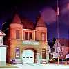
The still operational 1894 Engine House 26 (Fire Station) in the Black Rock/Riverside section of Buffalo at 703 Tonawanda Street. Taken at 11:00 PM on June 20, 2010.
image/jpeg, 1200x1200 (24bit)
EXIF: Focal Length 28mm, Exposure Time 15 Sec., Aperture f8
Show GPS Location in: Google Maps   Bing Maps   (New Window)
EngineHouse26_BlackRock_06-20-10_1165.jpg    359892 bytes

29/31


The Buffalo & Erie County Historical Society from across Mirror Lake. The star in the sky is Venus. This building was the New York State Building at the 1901 Pan-American Exposition and the only expo structure intended to be permanent. Taken at 10:39 PM, June 20, 2010.
image/jpeg, 1400x933 (24bit)
EXIF: Focal Length 35mm, Exposure Time 30 Sec., Aperture f11
Show GPS Location in: Google Maps   Bing Maps   (New Window)
BECHS_03_06-20-10_1160.jpg    143327 bytes

30/31


The Buffalo & Erie County Historical Society from across Mirror Lake. That's Honest Abe on the steps. It's a replica of the Lincoln Memorial in Washington, D.C. Taken at 10:37 PM, June 20, 2010.
image/jpeg, 1400x933 (24bit)
EXIF: Focal Length 75mm, Exposure Time 30 Sec., Aperture f9
Show GPS Location in: Google Maps   Bing Maps   (New Window)
BECHS_02_06-20-10_1158.jpg    260005 bytes

31/31


The Buffalo & Erie County Historical Society from across Mirror Lake. The star in the sky is Venus, note its reflection in the water. Taken at 10:14 PM, June 20, 2010.
image/jpeg, 1400x933 (24bit)
EXIF: Focal Length 28mm, Exposure Time 30 Sec., Aperture f4.5
Show GPS Location in: Google Maps   Bing Maps   (New Window)
BECHS_01_06-20-10_1150.jpg    167997 bytes


Henry's Page

Tammy's Page